
Finding People Along a Bartlesville Street
Use an exact Bartlesville street number first, then check that the address belongs in Washington County before treating a county result as a Bartlesville result. A Bartlesville address search works best as a record trail: parcel identity first, recorded ownership next, then dated tax or historical-address evidence. The physical Bartlesville property address is the situs. The Bartlesville mailing address is where notices go. They may be different, and either can belong to an owner, trustee, business, or tax representative rather than a current occupant.
- Normalize the Bartlesville mailing address with the official USPS lookup, including any directional word, street suffix, and unit.
- Search the Bartlesville address in the Washington County Assessor/OKLM map and retain the Bartlesville parcel account or identifier, legal description, and situs address.
- Use the map or Search List to inspect the same Bartlesville block. Record parcel identifiers rather than compiling a mass list of names.
- Take the current Bartlesville parcel owner and legal description to the Washington County Clerk's deed index, then preserve the document type and recording reference for any useful hit.
- For an older Bartlesville household question, compare dated Bartlesville tax rows and the address-oriented holdings at Bartlesville Public Library. A voter match, if a person voluntarily appears in the portal, is only registration context.
The Bartlesville sequence is address → parcel → legal description and owner → recorded instrument → dated household source. It keeps a Bartlesville address search grounded in the record that actually supports each claim.
Search the Bartlesville Street Directory in OKLM
The free Washington County Assessor/OKLM map is the practical starting point for a Bartlesville address-based street search. Its database search offers name, account, address, and legal-description routes, then returns a map or list that leads back to a Bartlesville parcel. County help says a parcel click populates ownership and the Property Record Card for Bartlesville property research. The Bartlesville viewer labels its data as reference information, not survey-grade material, and notes that technical or typographical errors can occur.
| OKLM label | Control | Required status | Address use |
|---|---|---|---|
| By Name | One text field | Not stated | Tests a Bartlesville owner-name lead. |
| By Account | One text field | Not stated | Finds a known Bartlesville parcel account using the last four or more digits. |
| By Address | One text field | Not stated | Searches the Bartlesville property or situs address. |
| By Legal | One text field | Not stated | Uses Bartlesville lot/block or section-township-range wording when a street name has changed. |
| 911 Address Search | One text field | Not stated | Runs the Bartlesville address-layer search. |
Open the Bartlesville-area OKLM Washington County map before using the address controls shown here.
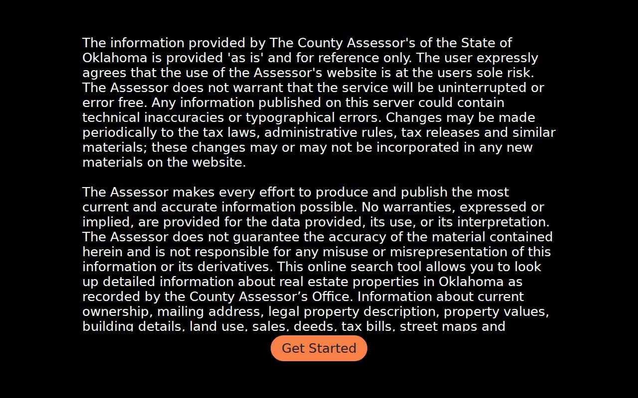
A Bartlesville result may expose ownership, mailing address, legal description, values, land use, sales, deeds, tax bills, and map links. The available categories are a useful inventory for Bartlesville property research, but the research did not retrieve a live detail card, so no owner, value, sale date, or account example belongs in a street search result.
Bartlesville Parcel Cards by Address
A Bartlesville parcel card can connect the records behind a street number without answering the question of occupancy. Use the card to capture the searched Bartlesville address, account or parcel identifier, current owner, situs and mailing fields, legal description, value or land-use information, and dated sales or deed references if the card displays them. The Washington County Assessor appraises Bartlesville-area real and personal property at fair cash value as of January 1 and works on a four-year revaluation cycle with visual inspection at least once in that cycle.
- Parcel
- A mapped Bartlesville-area unit of property assigned an account or identifier for county assessment and tax work.
- Situs address
- The physical Bartlesville location of the parcel. It is not automatically the owner's home address.
- Mailing address
- The address supplied for Bartlesville-area notices. It may be elsewhere and does not establish residence at the parcel.
- Plat
- A recorded Bartlesville-area map that divides land into lots and blocks. Its lot and block wording can survive an address change.
- Criss-cross directory
- An address-oriented Bartlesville directory that helps connect a street number with a dated listing, subject to its edition and coverage.
Bartlesville-area homestead status is also narrow. Washington County says it requires an owner of record to reside at the property on January 1, but it is an exemption clue, not a public certificate of everyone living at a Bartlesville address.
Walk a Bartlesville Block in GIS
After locating a Bartlesville parcel, the county help tool permits Database Search results as either a map or list. Select a Bartlesville parcel, inspect its record details, then move along the Bartlesville block one parcel at a time. The viewer offers Parcel and 911 Address overlays, with the 911 layer available only at zoom 18. Its record-card drawer can link to office images and Street View, but those convenience features do not replace the Washington County Clerk's legal record.
Bartlesville City GIS and Mapping adds a different Bartlesville layer: zoning, property information, lot boundaries, printable street maps, address ranges, wards, fire zones, floodplain information, and city limits. The linked Bartlesville parcel-address ArcGIS service was unavailable during the research inspection, so exact live fields and layer dates should be checked in the current service. Use the Bartlesville city layer for location and jurisdiction, not as a personal-identification tool or survey.
Bartlesville Records by Street
Bartlesville address-keyed sources do not carry the same meaning. The Bartlesville-area Assessor and Treasurer can supply property and tax leads. The Washington County Clerk keeps Bartlesville recorded land instruments. Bartlesville City GIS describes the physical and municipal context. The Oklahoma Voter Portal is designed for a Bartlesville voter using a precise name and date of birth, not for making a street-by-street resident list. Pair each Bartlesville result with its custodian, selected year, and record purpose.
| Address record | Custodian | Useful street detail | Access caution |
|---|---|---|---|
| Parcel/property card | Washington County Assessor | Current Bartlesville-area ownership, situs, mailing address, legal description, value, and deed or tax links if shown. | Free reference viewer, not survey-grade. |
| Tax roll | Washington County Treasurer | Bartlesville-area tax year, Tax ID, owner or business name, property ID, type, base tax, total due, and unpaid status. | Keep the selected year; a tax row is not title proof. |
| Recorded instruments | Washington County Clerk | Bartlesville deeds, mortgages, releases, liens, and plats tied to names or legal descriptions. | Online start date was not located; older books may need clerk help. |
| Parcel and city layers | County GIS and Bartlesville City Engineering | Bartlesville parcel position, 911 address layer, lot boundary, zoning, ward, and city-limit context. | Map layers are not a survey or occupancy list. |
| Historical directories | Bartlesville Public Library and OHS | Dated address or household leads. | Edition gaps and access rules apply. |
Open the Bartlesville-area Washington County tax-roll search to see its owner, business, first-name, last-name, tax-year, and unpaid-tax options.
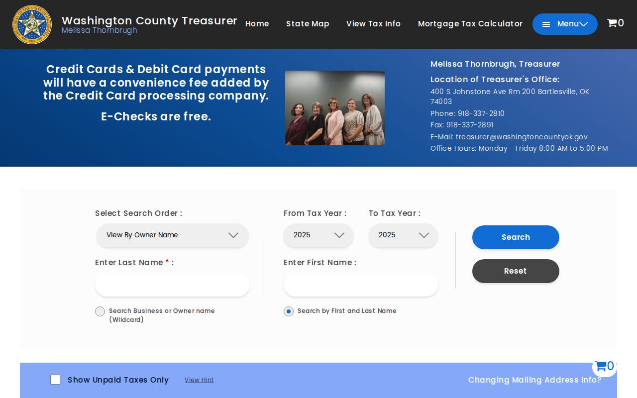
The Bartlesville tax screen organizes a result around tax year, Tax ID, owner name, property ID, property type, base tax, total due, and payment action. Record the Bartlesville search order and whether the unpaid-only option was used. Tax ownership, assessed ownership, and recorded title can change on different schedules.
Bartlesville Deed Names Along the Street
The County Clerk is the legal-record custodian for deeds, mortgages, releases, liens, plats, and other recorded instruments. From a street address, carry the assessor's current owner and legal description into OKCountyRecords. Record the instrument type, recording date, book/page or instrument number, grantor, grantee, consideration if shown, legal description, and whether an image or certification is available. An index hit is a lead until the recorded instrument is read.
Open the Washington County Clerk's linked land-record portal before following its current sign-in and search flow.
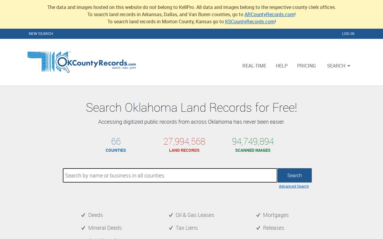
The research could not document a public online coverage start date or the portal's live grantor/grantee fields because of its dynamic login flow. For older instruments or copy details, contact land records at the County Clerk, 400 S Johnstone, Room 100, 918-337-2834. The Clerk also advertises a free recording-name and legal-description alert.
Bartlesville Voter Searches Have Limits
The OK Voter Portal asks for Last Name, First Name, and Date of Birth, all marked required. It helps a voter check registration status, polling place, early-voting information, sample ballot, districts, and change-related functions. It is not designed for a reverse lookup by street. A non-match can reflect a spelling difference, recent move, cancellation, protected record, or how the name is indexed, so it does not show that someone is not a Bartlesville resident.
Open the official Oklahoma voter lookup to see the required identity fields.
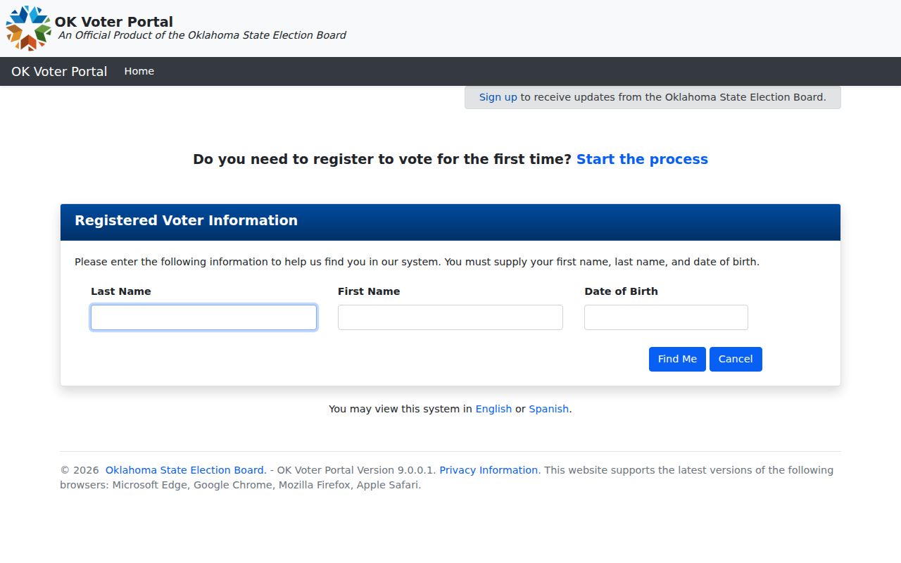
Oklahoma identifies some registration data as public while protecting application source, driver-license or state-ID information, and Social Security numbers. Restricted Records and Address Confidentiality Program participants are intentionally omitted or protected. Do not publish a full date of birth or protected address from a search result.
Bartlesville Street Names Need Cross-Checks
Street names can break an otherwise sound address trail. On July 3, 2024, the City reported that the east-west portion of Oak Park Road was renamed Roane Road because the Arcadian/Oak Wood Addition plat recorded in 1982 had left both east-west and north-south segments with the Oak Park Road name. Search Oak Park Road and Roane Road together when an older directory, deed, tax row, or newspaper notice seems to stop.
A separate April 3, 2024 City action gave Fifth Street between Delaware and Shawnee the honorary Jim Hess Boulevard designation. The City specifically said mailing addresses remain unchanged. An honorary sign is not a new USPS, recorder, or legal mailing address, so retain Fifth Street when matching official records.
Bartlesville Addresses Span Two Counties
The 2024 Census BAS map places Bartlesville city in both Washington and Osage counties. Washington County's assessor, Clerk, and court records therefore do not automatically cover every address that uses Bartlesville as a mailing city. A Washington County rural parcel can also use Bartlesville without being inside the municipal boundary. Check the city-limits layer, Census boundary context, and USPS-standardized address when jurisdiction matters.
ZIP codes answer a mailing question, city limits answer a municipal question, and county records answer a jurisdiction question. Those three answers may not match. The Bartlesville ZIP Code Directory keeps the postal geography separate from this street-level record trail.
Older Bartlesville Address Leads
For a past address, Bartlesville Public Library's Local & Family History department holds city directories on microfiche from 1907 through 2000, plus newspaper microfilm and an obituary file. Exact street spelling, number, edition, neighboring entries, and any household or business notation matter more than a name alone. Directory gaps, initials, telephone-only listings, and changed addresses can create a false break in a trail.
The Bartlesville City Directory page focuses on those collections and how to read an entry. The 1917 Library of Congress Sanborn map adds building, lot, street, and fire-infrastructure context for its mapped date, but it is not a list of people who lived at a property.
Bartlesville Parcel Counts Are Not People Counts
Washington County's 2026 parcel page reports 30,748 instrument-conveyance parcels: 21,865 residential, 1,664 commercial, 4,557 agricultural, and 2,682 exempt. Those are county parcel categories, not a count of Bartlesville people, homes, mailing addresses, or occupied properties. The distinction matters when using address records for property history.
Use the count as context for the scale of the county's parcel system, not as a reason to infer an occupant from an address or from an owner name.
Limits of a Bartlesville Street Directory
Address records can show property, recorded instruments, tax, map, or dated directory leads. They cannot safely turn a mailing address into a current-resident claim. The Oklahoma Open Records Act gives access to existing records but does not require a custodian to create a combined person report, and exemptions still apply. A shared surname, business address, cemetery entry, or one stale record is not enough to attach a living person to a home.
Lawful use. Use Bartlesville address records for personal, family-history, estate, civic, or property research. Do not use a record trail to stalk, harass, intimidate, or harm anyone, and stop when an address is protected or the identity remains uncertain.